Title:
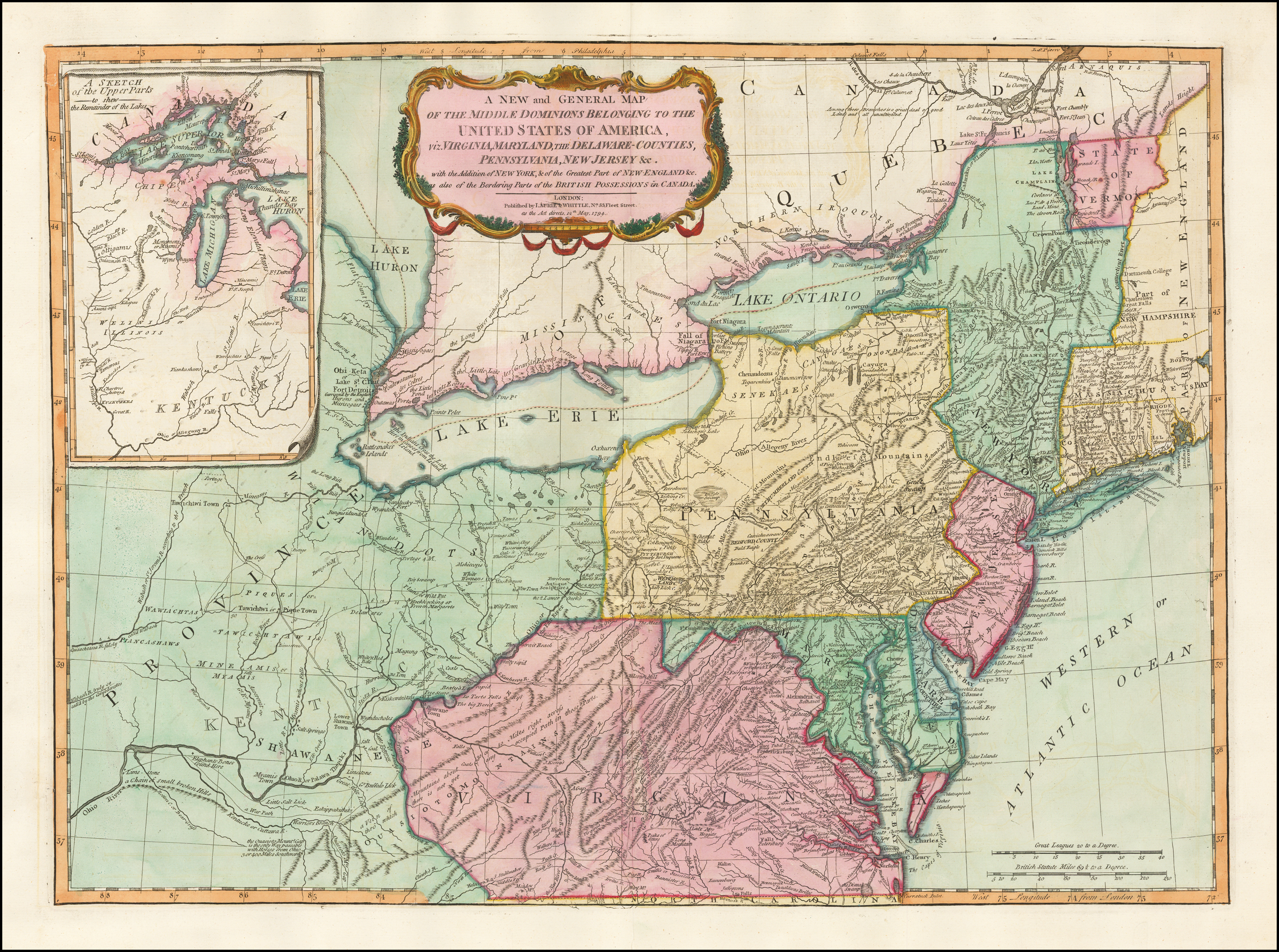
“A New and General Map of the Middle Dominions Belonging to the United States of America, viz. Virginia, Maryland, The Delaware-Counties, Pennsylvania, New Jersey &c. . . 1794”
Map Maker:
Richard Holmes Laurie
Finely Colored Example of the Final Edition of the... (full text available to subscribers)
| Item Detail |
| |
| |
MapMaker: |
Richard Holmes Laurie
|
|
| |
| |
Subject: |
New York City |
|
| |
Period/Size: |
1794 / 19.5" x 26.0" (49.6 x 66.1 cm)
|
|
| |
Color: |
Colored
|
|
| |
Condition: |
VG (condition help) |
|
| |
Source: |
|
|
| |
References: |
|
|
| |
|
|
| Sales Information |
| |
| |
Price: |
|
|
| |
| |
Offered by: |
Barry L. Ruderman Antique Maps Inc. |
|
| |
Catalog: |
Recently Added - December 2021 (9534) |
|
| |
Lot/Item #: |
49212 |
|
| |
| |
Date: |
12/2021
|
|
| |
| |
|
Antique Maps - Valuation and Pricing, Descriptions, Resources |
|
Home |
Information |
Search |
Register |
Contact Us |
Site Map
Americana Exchange, Inc. © 1999 - 2024 Americana Exchange, Inc.. All rights reserved.
OldMaps.com, the OldMaps.com logo and
AMPR are service marks or registered service marks of Americana Exchange, Inc..
|