Title:
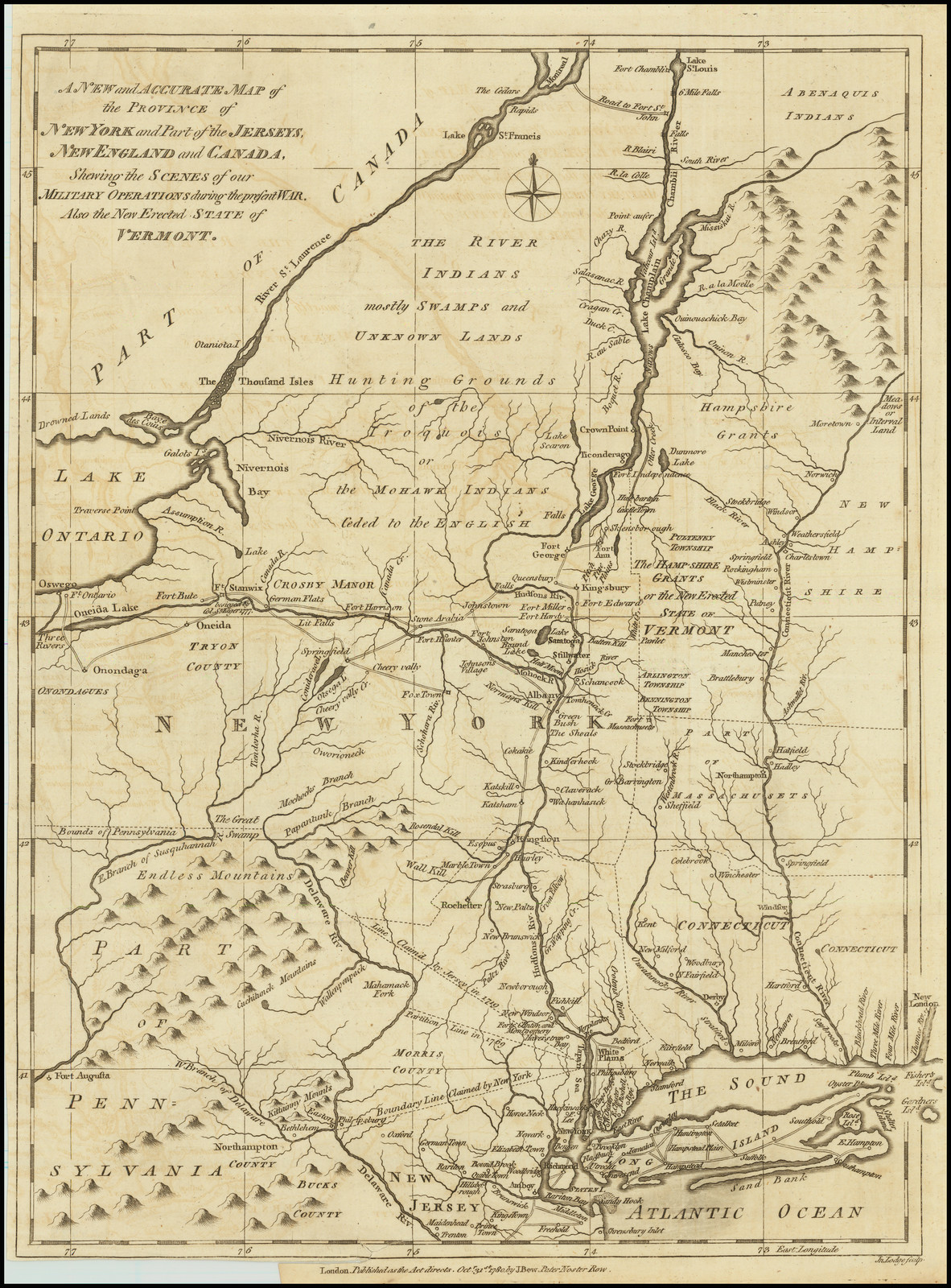
“A New and Accurate Map of the Province of New York and Part of the Jerseys, New England and Canada, Shewing the Scenes of our Military Operations during the present War. Also the New Erected State of Vermont.”
Map Maker:
John Lodge
Scarce regional map showing the field of military ... (full text available to subscribers)
| Item Detail |
| |
| |
MapMaker: |
John Lodge
|
|
| |
| |
Subject: |
New Hampshire |
|
| |
Period/Size: |
1780 / 15.0" x 11.0" (38.1 x 28.0 cm)
|
|
| |
Color: |
Unknown
|
|
| |
Condition: |
VG (condition help) |
|
| |
Source: |
|
|
| |
References: |
|
|
| |
|
|
| Sales Information |
| |
| |
Price: |
|
|
| |
| |
Offered by: |
Barry L. Ruderman Antique Maps Inc. |
|
| |
Catalog: |
Recently Added - December 2021 (9534) |
|
| |
Lot/Item #: |
78206 |
|
| |
| |
Date: |
12/2021
|
|
| |
| |
|
Antique Maps - Valuation and Pricing, Descriptions, Resources |
|
Home |
Information |
Search |
Register |
Contact Us |
Site Map
Americana Exchange, Inc. © 1999 - 2024 Americana Exchange, Inc.. All rights reserved.
OldMaps.com, the OldMaps.com logo and
AMPR are service marks or registered service marks of Americana Exchange, Inc..
|