Title:
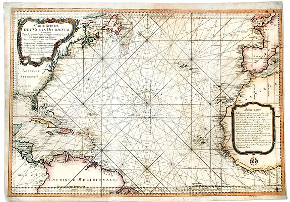
“ Carte Reduite de l' OCEAN OCCIDENTAL Contenant Partie des Costes d' Europe et d' Afrique… M DCCLXVI”
Map Maker:
Jacques Nicolas Bellin
An decorative maritime chart, by the one of the gr... (full text available to subscribers)
| Item Detail |
| |
| |
MapMaker: |
Jacques Nicolas Bellin
|
|
| |
| |
Subject: |
Atlantic Ocean New data: Caribbean & Atlantic Ocean |
|
| |
Period/Size: |
1766 / 24.0" x 34.1" (61.0 x 86.7 cm)
|
|
| |
Color: |
Colored
|
|
| |
Condition: |
Age toned. Some foxing. Short margins. Some wrinkles and wear on edges and top right corner. (condition help) |
|
| |
Source: |
Hydrographie Françoise |
|
| |
References: |
|
|
| |
|
|
| Sales Information |
| |
| |
Price: |
|
|
| |
| |
Offered by: |
Paulus Swaen Old Maps & Prints |
|
| |
Catalog: |
October 15, 2019 Internet Auction (9473) |
|
| |
Lot/Item #: |
83182 |
|
| |
| |
Date: |
10/2019
|
|
| |
| |
|
Antique Maps - Valuation and Pricing, Descriptions, Resources |
|
Home |
Information |
Search |
Register |
Contact Us |
Site Map
Americana Exchange, Inc. © 1999 - 2024 Americana Exchange, Inc.. All rights reserved.
OldMaps.com, the OldMaps.com logo and
AMPR are service marks or registered service marks of Americana Exchange, Inc..
|