Title:
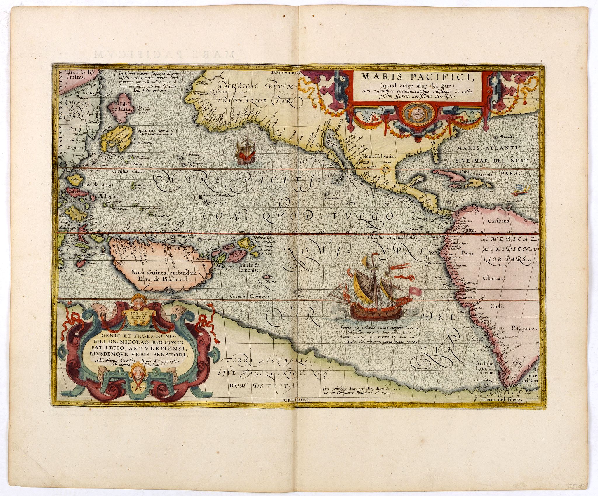
“Maris Pacifici, (quod vulgo Mar del Zur) cum regionaribus circumiacentibus, insulisque in eodem passim sparsis, novissima descripto.”
Map Maker:
ORTELIUS, A.
This was the first printed map to be devoted solel... (full text available to subscribers)
| Item Detail |
| |
| |
MapMaker: |
ORTELIUS, A.
|
|
| |
| |
Subject: |
Pacific Ocean |
|
| |
Period/Size: |
1590-1603 / 19.6" x 13.5" (49.8 x 34.4 cm)
|
|
| |
Color: |
Colored
|
|
| |
Condition: |
Very good condition. Very good impression. Latin text on verso. (condition help) |
|
| |
Source: |
|
|
| |
References: |
Burden, 74. Van den Broecke 12. |
|
| |
|
|
| Sales Information |
| |
| |
Price: |
|
|
| |
| |
Offered by: |
Paulus Swaen Old Maps & Prints |
|
| |
Catalog: |
May 2020 Internet Auction (9517) |
|
| |
Lot/Item #: |
35751 |
|
| |
| |
Date: |
05/2020
|
|
| |
| |
|
Antique Maps - Valuation and Pricing, Descriptions, Resources |
|
Home |
Information |
Search |
Register |
Contact Us |
Site Map
Americana Exchange, Inc. © 1999 - 2024 Americana Exchange, Inc.. All rights reserved.
OldMaps.com, the OldMaps.com logo and
AMPR are service marks or registered service marks of Americana Exchange, Inc..
|