Title:
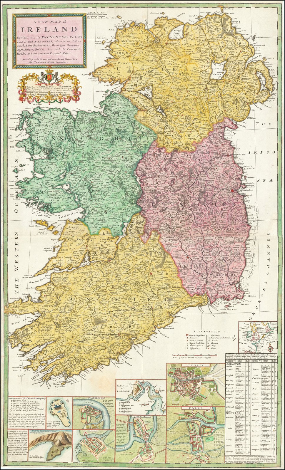
“A New Map of Ireland Divided into its Counties, Provinces, and Baronies, wherein are Distinguished the Bishopricks, Borroughs, Barracks, Bogs, Passes, Bridges, &c., with the Principal Roads, and Common Reputed Miles”
Map Maker:
Herman Moll
Finely colored map of Ireland, published by Herman... (full text available to subscribers)
| Item Detail |
| |
| |
MapMaker: |
Herman Moll
|
|
| |
| |
Subject: |
Ireland |
|
| |
Period/Size: |
c. 1714 / 43.0" x 24.0" (109.3 x 61.0 cm)
|
|
| |
Color: |
Colored
|
|
| |
Condition: |
Good (condition help) |
|
| |
Source: |
|
|
| |
References: |
|
|
| |
|
|
| Sales Information |
| |
| |
Price: |
|
|
| |
| |
Offered by: |
Barry L. Ruderman Antique Maps Inc. |
|
| |
Catalog: |
Recently Added - December 2021 (9534) |
|
| |
Lot/Item #: |
68127 |
|
| |
| |
Date: |
12/2021
|
|
| |
| |
|
Antique Maps - Valuation and Pricing, Descriptions, Resources |
|
Home |
Information |
Search |
Register |
Contact Us |
Site Map
Americana Exchange, Inc. © 1999 - 2024 Americana Exchange, Inc.. All rights reserved.
OldMaps.com, the OldMaps.com logo and
AMPR are service marks or registered service marks of Americana Exchange, Inc..
|