Title:
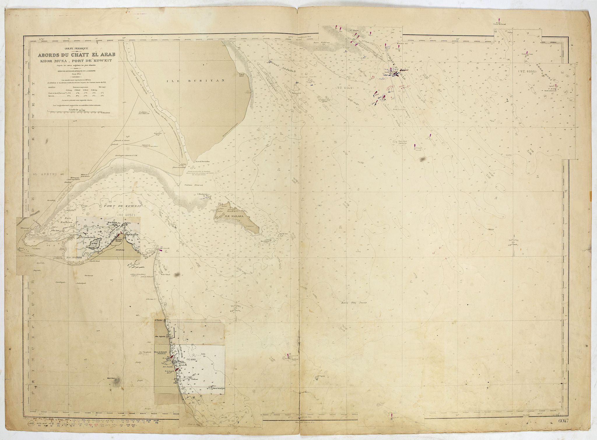
“Abords du Chatt El Arab - Khor Musa- Port de Koweit . . .”
Map Maker:
SERVICE HYDROGRAPHIQUE DE LA MARINE
Large chart representing Kuwait and its harbour. A... (full text available to subscribers)
| Item Detail |
| |
| |
MapMaker: |
SERVICE HYDROGRAPHIQUE DE LA MARINE
|
|
| |
| |
Subject: |
Arabian Peninsula |
|
| |
Period/Size: |
1952-58 / 39.6" x 28.0" (100.5 x 71.0 cm)
|
|
| |
Color: |
Colored
|
|
| |
Condition: |
Dark impression, printed on heavy paper. Browned paper. 20 cm tear in the bottom center fold Professionally repaired. (condition help) |
|
| |
Source: |
|
|
| |
References: |
|
|
| |
|
|
| Sales Information |
| |
| |
Price: |
|
|
| |
| |
Offered by: |
Paulus Swaen Old Maps & Prints |
|
| |
Catalog: |
June 2020 Internet Auction (9518) |
|
| |
Lot/Item #: |
43106 |
|
| |
| |
Date: |
06/2020
|
|
| |
| |
|
Antique Maps - Valuation and Pricing, Descriptions, Resources |
|
Home |
Information |
Search |
Register |
Contact Us |
Site Map
Americana Exchange, Inc. © 1999 - 2024 Americana Exchange, Inc.. All rights reserved.
OldMaps.com, the OldMaps.com logo and
AMPR are service marks or registered service marks of Americana Exchange, Inc..
|