Title:
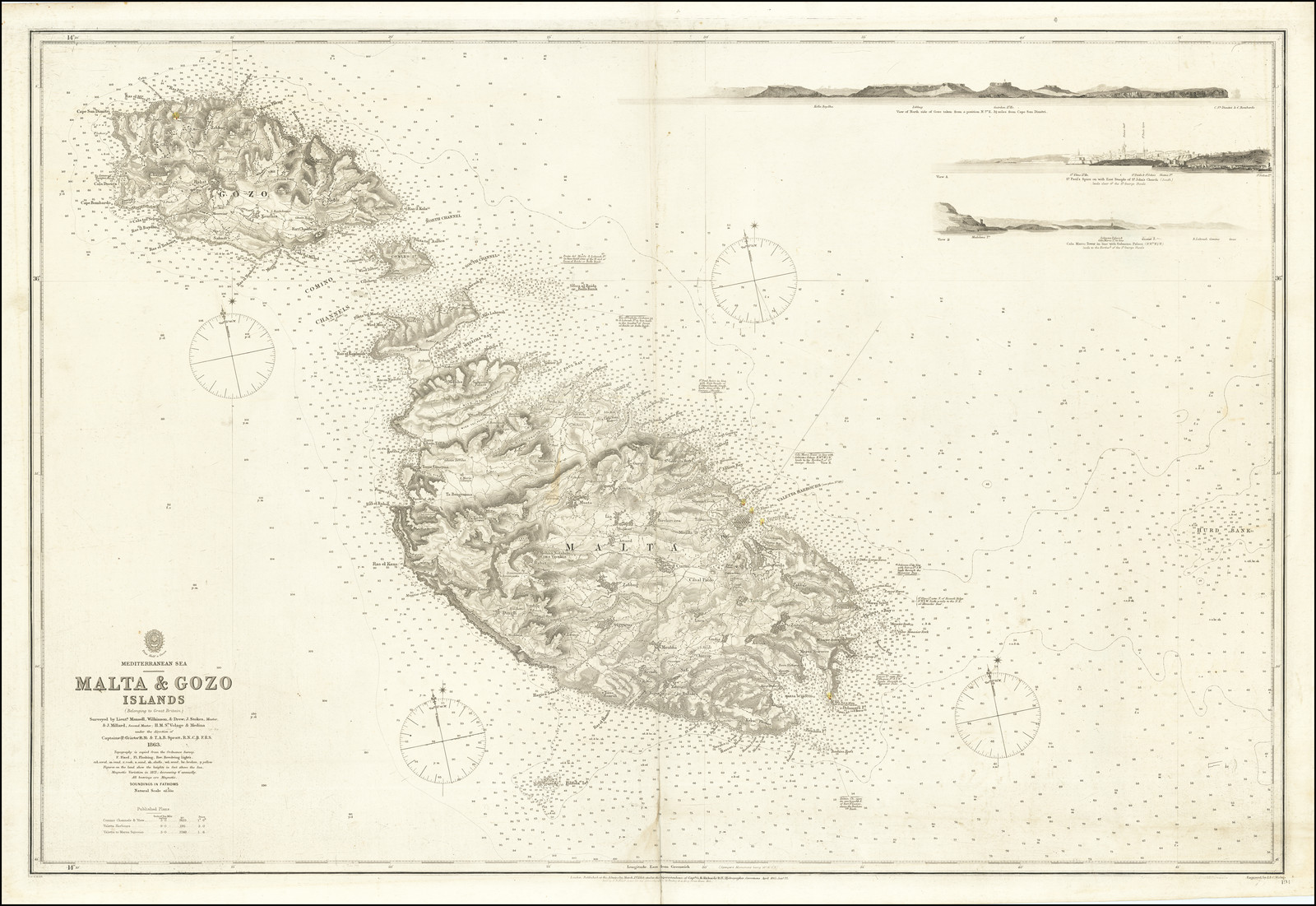
“Malta & Gozo Islands (Belonging to Great Britain) Surveyed by Lieuts. Mansell, Wilkinson, & Drew . J Stokes Mastr & J Millard second master HMS Volage & Medina under the direction of Captains T Graves RN & TAB Spratt RN CB FRS. 1863”
Map Maker:
British Admiralty
Scarce separately published sea chart of Malta and... (full text available to subscribers)
| Item Detail |
| |
| |
MapMaker: |
British Admiralty
|
|
| |
| |
Subject: |
Malta / |
|
| |
Period/Size: |
1865 (1872) / 25.0" x 37.0" (63.5 x 94.0 cm)
|
|
| |
Color: |
Unknown
|
|
| |
Condition: |
VG / Minor Soiling. (condition help) |
|
| |
Source: |
|
|
| |
References: |
|
|
| |
|
|
| Sales Information |
| |
| |
Price: |
|
|
| |
| |
Offered by: |
Barry L. Ruderman Antique Maps Inc. |
|
| |
Catalog: |
Recently Added - July 2021 (9521) |
|
| |
Lot/Item #: |
74902 |
|
| |
| |
Date: |
07/2021
|
|
| |
| |
|
Antique Maps - Valuation and Pricing, Descriptions, Resources |
|
Home |
Information |
Search |
Register |
Contact Us |
Site Map
Americana Exchange, Inc. © 1999 - 2024 Americana Exchange, Inc.. All rights reserved.
OldMaps.com, the OldMaps.com logo and
AMPR are service marks or registered service marks of Americana Exchange, Inc..
|