| Item Detail |
| |
| |
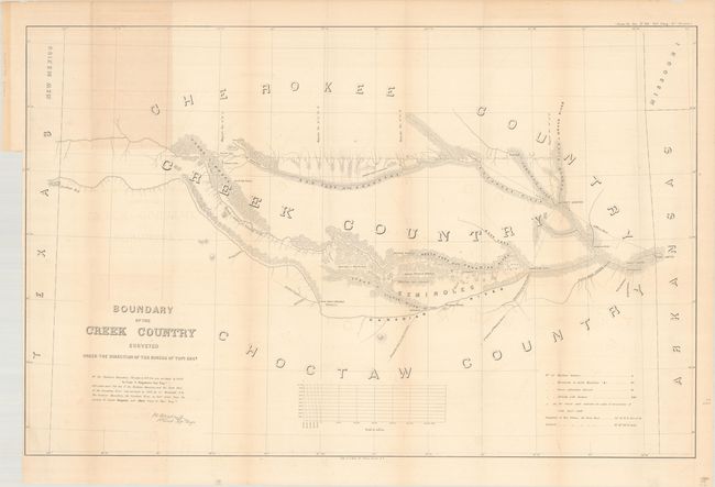
MapMaker: |
Sitgreaves
|
|
| |
| |
Subject: |
Oklahoma |
|
| |
Period/Size: |
1849 / 23.7" x 37.0" (60.2 x 94.0 cm)
|
|
| |
Color: |
Black & White
|
|
| |
Condition: |
(B+) Folding as issued with minor offsetting, light toning along some folds and a segment at top where the map was attached to the report, and a couple of very short tears at fold intersections. (condition help) |
|
| |
Source: |
House Ex. Doc. No. 104, 35th Congress, 1st Session |
|
| |
References: |
Phillips (Maps) p.251. |
|
| |
|
|
| Sales Information |
| |
| |
Price: |
|
|
| |
| |
Offered by: |
Old World Auctions |
|
| |
Catalog: |
Auction No. 192 - Antique Maps, Charts, Atlases & Globes (9562) |
|
| |
Lot/Item #: |
289 |
|
| |
| |
Date: |
04/2023
|
|
| |
| |
|