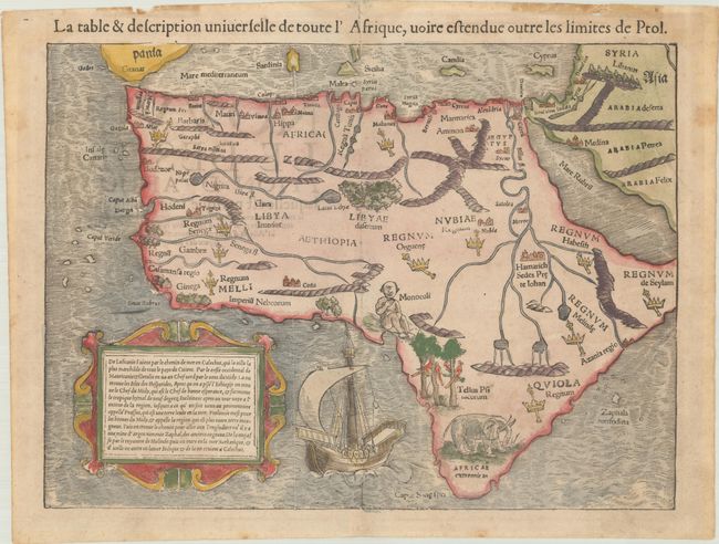
Title:
“La Table & Description Universelle de Toute l'Afrique, Voire Estendue Outre les Limites de Ptol”
Map Maker:
Sebastian Munster
This woodcut map is one of the earliest maps of th... (full text available to subscribers)
| Item Detail |
| |
| |
MapMaker: |
Sebastian Munster
|
|
| |
| |
Subject: |
Africa |
|
| |
Period/Size: |
1568 / 10.1" x 13.6" (25.7 x 34.6 cm)
|
|
| |
Color: |
Colored
|
|
| |
Condition: |
(B+) Light soiling with extraneous creasing in the top margin and old tape stains along the top edge of the sheet that have caused some tiny chips and tears. (condition help) |
|
| |
Source: |
La Cosmographie Universelle... |
|
| |
References: |
Betz #3; Norwich #2. |
|
| |
|
|
| Sales Information |
| |
| |
Price: |
|
|
| |
| |
Offered by: |
Old World Auctions |
|
| |
Catalog: |
Auction No. 191 - Antique Maps, Charts, Atlases & Globes (9561) |
|
| |
Lot/Item #: |
724 |
|
| |
| |
Date: |
02/2023
|
|
| |
| |
|
Antique Maps - Valuation and Pricing, Descriptions, Resources |
|
Home |
Information |
Search |
Register |
Contact Us |
Site Map
Americana Exchange, Inc. © 1999 - 2024 Americana Exchange, Inc.. All rights reserved.
OldMaps.com, the OldMaps.com logo and
AMPR are service marks or registered service marks of Americana Exchange, Inc..
|